




















































































































































































































































































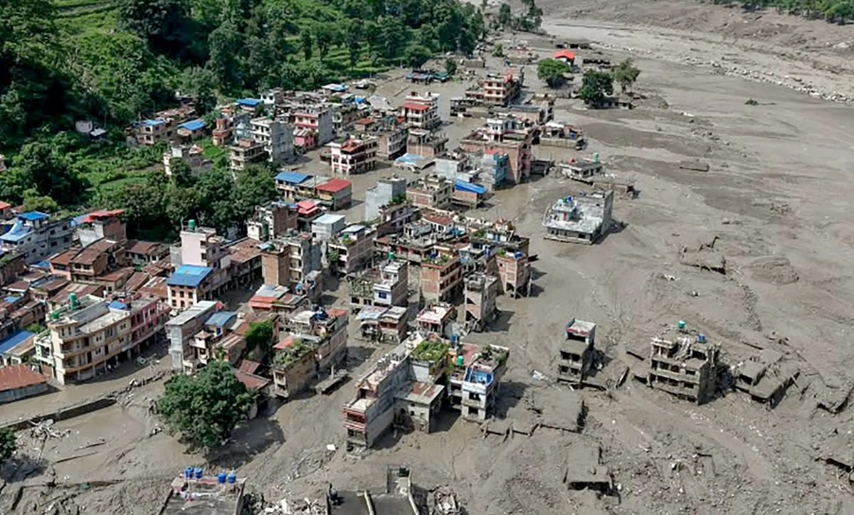
The devastating flash floods in Nepal have once again highlighted the growing risks emerging from a rapidly changing Himalayan environment. As scientists investigate the possible role of a glacier collapse in the disaster, attention has also turned to warnings issued months earlier about accelerating glacier loss and the increasing threat of glacial lake outburst floods.
Around five months before the Nepal disaster, two reports released by the International Centre for Integrated Mountain Development (ICIMOD) had raised concerns over the changing conditions across the Hindu Kush Himalaya region. The reports, titled “Changing Dynamics of Glaciers in the Hindu Kush Himalaya Region from 1990 to 2020” and “HKH Glacier Outlook 2026”, documented the accelerating loss of glacier ice and the hazards that could affect communities living downstream.
According to the reports, glaciers in the upper Himalayas lost nearly 12 per cent of their total area and around 9 per cent of their estimated ice reserves between 1990 and 2020. ICIMOD Remote Sensing Analyst Sudan Bikash Maharjan said the changes had intensified hazards such as glacial lake outburst floods.
The reports also warned about the nearly two billion people living downstream who depend on meltwater from the region’s “Water Towers of Asia”. The risk is particularly concerning because around three-quarters of the region’s glaciers fall into a vulnerable size category.
The HKH Glacier Outlook 2026, which examined 38 glaciers, found that the rate of glacier loss had doubled since 2000. It warned that parts of the Himalayan cryosphere could be approaching critical tipping points that may lead to irreversible glacier retreat.
The report also cautioned that if global climate action fails and emissions continue to rise rapidly, as much as two-thirds of the region’s glaciers could disappear by 2100.
Meanwhile, scientists and geologists are examining whether a glacier collapse followed by an ice-rock avalanche triggered the devastating flash floods along the Bhote Koshi River on Wednesday. Preliminary assessments suggest that debris may have blocked the Lhende River temporarily, creating a natural landslide dam. When the blockage eventually gave way, a powerful surge of water and debris swept through Nepal’s Rasuwa district.
Satellite imagery analysed by ISRO’s National Remote Sensing Centre has provided further evidence of a major glacier collapse. The images indicate that nearly two-thirds of the glacier had separated from its original position.
A Sentinel-2 image captured on August 24 showed the glacier intact. However, a Landsat-9 image taken after the disaster on Wednesday showed a large scar at the site of the collapse.
The satellite images also revealed a wide trail of ice and rock debris moving towards the river. Scientists are continuing to study the sequence of events to determine how the glacier collapse, temporary river blockage and subsequent flood combined to cause the devastating disaster in Nepal.